The Port of Weymouth
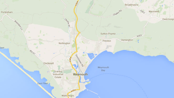
The town of Weymouth is in Dorset, eight miles south of Dorchester. The Ferry Port is located on Weymouth Bay at the mouth of the River Wey on the English Channel coast, just north of the Isle of Portland. Condor Ferries operates crossings to St. Malo, Jersey and Guernsey with an average of 21 weekly sailings.
| Cross channel operators |
Departure |
Destination |
Weekly Crossings |
Duration |
 Condor Ferries Condor Ferries |
Guernsey |
Weymouth |
8 |
2h 30min |
| Condor Ferries |
Jersey |
Weymouth |
7 |
4 hours |
| Condor Ferries |
St Malo |
Weymouth |
7 |
6 hours |
| |
|
|
|
|
| GPS co ordinates |
Latitude |
Longitude |
| Weymouth Terminal |
50º36'33.2" N (50.60923 N) |
2º26'43" W (-2.44528 E) |
| |
|
|
Weymouth Ferry Port by Car
Weymouth can be approached from the A35 at Poole. Follow the A351, then the A352, and the A353 into the Town Centre. Coming from the North you can take the A354 for about 8 miles from Dorchester and follow the signs to Ferries/Ferry Port, situated on the left.
Updated:
20 April 2024
by Paul Quigley